0
You have 0 items in your cart
Click the photo to resize for your screen. Scroll to the bottom for image details.
Storm season in Saskatchewan is always quite spectacular, that’s a given. We get some of the best supercell thunderstorms in the world. The question, however, revolves around where and when. After some fun (and not so fun) storm chases on July 4th and July 7th, the next big day the models predicted was July 12th with the prime area looking like storms would fire late afternoon about an hour south of home. So that afternoon, I monitored satellite and radar, waiting for something to show up. It was just a big, wide-open sky, clear of any cumulus clouds. As I was about to give up hope, I noticed some cumulus clouds beginning to tower right over my house and made the determination then and there that this was it. I took off chasing this little band of towering cumulus northeast. It was half an hour before it even showed up on the radar, but by then, an updraft base was forming, and I had a hunch that things were going to work in my favour. As a storm timelapse photographer, I enjoy storms like this one. It was only moving at about 60 km/h, which made it easy to stay 5-10 minutes in front of and grab 3-400 shot sequences at each stop. In the end, this storm was responsible for 15 timelapse sequences, which equates to 153.2 GB of data. Here is one photograph as the storm approached this abandoned house on a hill. I wasn’t in a good position for a timelapse but when you’re able to grab a photograph of one of these massive structures with a foreground that people can relate to that gives the storm a sense of scale, you do it
To purchase a luxury fine art print of this photo please use the button below.
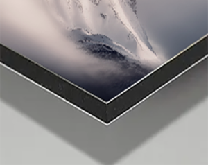
Acrylic Facemount Prints offer unrivalled clarity and sharpness with vivid colours. Your image is first printed to a metallic paper that offers extra pop, then 1/8″ thick Cast Acrylic is reverse face-mounted using crystal clear OptiTac adhesive that provides permanent and invisible adhesion. Each piece is then backed with 1/8″ thick aluminum Dibond which offers superb rigidity with all hanging hardware attached to the back. The result is an unmatched piece of art that has a contemporary feel with striking visual depth. This is the premier presentation for my photographs that bring detail and colour to life in a way that traditional presentations cannot.


Representative only. Each piece will come in various sizes that depend on the image orientation and resolution.
24″x36″ – $880
32″x48″ – $1,350
40″x60″ – $1,975

Fine Art Metal Prints are a fantastic budget-conscious choice that preserves high details and colour rendition without sacrificing on quality. Your artwork is printed onto subtle metallic white film with a 4mm UV laminate with a very subtle texture. These prints offer good sharpness, detail, and colour precision. Metal Prints produce vibrant colours and come in a matte, low-reflective finish, making them ideal for areas of the home with lots of ambient light. Lightweight and durable, the edges are finished square and smooth for a sleek, modern look and come ready to hang.
Representative only. Each piece will come in various sizes that depend on the image orientation and resolution.
24″x36″ – $680
32″x48″ – $950
40″x60″ – $1,400
