0
You have 0 items in your cart
Click the photo to resize for your screen. Scroll to the bottom for image details.
The 2022 storm season was a busy one for me. Before July 8th, I had seen four tornadoes and had witnessed some great structure. The risk area for July 8th was fairly large, but the primary area of concern seemed to be focused west of Saskatoon. As a Regina resident, I hate chasing north and west of Saskatoon. It’s about 3 hours of driving to get there, and then you’re normally driving away from home while you chase, which makes the return trip even longer.
My friend Herry and I decided to go to an area with more marginal risk just south of Saskatoon around Hanley or Kenaston – at least it was a bit closer to home. As we watched the cumulus field go up and down, we watched the radar and knew we were missing out on some action. A cell by North Battleford put down a tornado, then another. As it was still early, we decided to keep moving north along the front edge of the cumulus field to somewhere just north of Saskatoon. As we drove, the North Battleford cell put down its third tornado, and our decision became more complicated. That cell looked like it was weakening, and we knew that if we pushed west to try and get to it, we’d miss out on a storm that might build out in front of it. So we stayed put and, sure enough, something developed out in front of the dying North Battleford cell. We moved into position, and as we approached, it became clear that this storm was strengthening. We stopped in our first timelapse position, jumped out of the vehicle and saw a large cone tornado on the ground. After timelapsing from that spot, we decided to try and get a little closer. After moving, the tornado began to weaken and rope out, which was when I captured this scene.
To purchase a luxury fine art print of this photo, please use the button below.
Acrylic Facemount Prints offer unrivalled clarity and sharpness with vivid colours. Your image is first printed to a metallic paper that offers extra pop, then 1/8″ thick Cast Acrylic is reverse face-mounted using crystal clear OptiTac adhesive that provides permanent and invisible adhesion. Each piece is then backed with 1/8″ thick aluminum Dibond which offers superb rigidity with all hanging hardware attached to the back. The result is an unmatched piece of art that has a contemporary feel with striking visual depth. This is the premier presentation for my photographs that bring detail and colour to life in a way that traditional presentations cannot.


Representative only. Each piece will come in various sizes that depend on the image orientation and resolution.
24″x36″ – $880
32″x48″ – $1,350
40″x60″ – $1,975

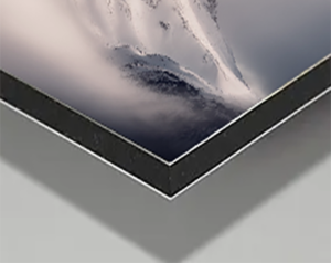
Fine Art Metal Prints are a fantastic budget-conscious choice that preserves high details and colour rendition without sacrificing on quality. Your artwork is printed onto subtle metallic white film with a 4mm UV laminate with a very subtle texture. These prints offer good sharpness, detail, and colour precision. Metal Prints produce vibrant colours and come in a matte, low-reflective finish, making them ideal for areas of the home with lots of ambient light. Lightweight and durable, the edges are finished square and smooth for a sleek, modern look and come ready to hang.
Representative only. Each piece will come in various sizes that depend on the image orientation and resolution.
24″x36″ – $680
32″x48″ – $950
40″x60″ – $1,400
